When Columbus sailed west in 1492, he navigated using instruments refined over centuries by Arab astronomers, Chinese inventors, and Mediterranean traders. These 10 technologies transformed the Atlantic from an impassable barrier into a highway of empires.
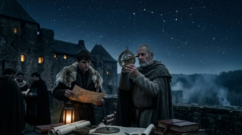
1. The Mariner’s Astrolabe Brought Stars Within Reach
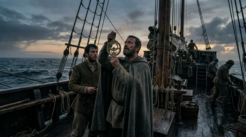
Portuguese mariners revolutionized oceanic navigation around 1480 when they adapted the complex Islamic astrolabe into a simplified brass instrument weighing 5 to 8 pounds. Unlike its astronomical cousin with dozens of moving parts, the mariner’s astrolabe featured just a rotating alidade and degree markings around its circumference. Vasco da Gama carried one on his 1497 voyage to India, using it to measure the sun’s altitude at noon and determine his latitude to within 2 degrees accuracy. The instrument’s heavy weight proved essential—it had to hang vertically despite rolling decks and Atlantic gales. Spanish pilots mandated astrolabes on all trans-oceanic vessels after 1500, making them the first standardized navigation technology. By 1520, Lisbon workshops produced over 300 astrolabes annually, each stamped with the maker’s mark and tested against known latitudes. The tool’s limitation became apparent in rough seas, where the brass disc swung wildly, forcing navigators to wait hours for calm conditions. Despite this, astrolabes remained the primary latitude instrument until sextants replaced them in the 1730s, giving European explorers two and a half centuries of celestial navigation capability that no other maritime culture possessed at such scale.
Source: britannica.com
2. The Dry-Card Compass Made Real-Time Course Plotting Possible
Italian craftsmen in Amalfi perfected the dry-card compass around 1300, mounting a magnetized needle beneath a paper disc marked with 32 compass points. This innovation eliminated the water-filled bowls Chinese navigators had used since 1040, which froze in northern waters and sloshed dangerously in storms. The dry-card design suspended the entire assembly on a brass pin, allowing it to rotate freely inside a wooden binnacle box. By 1490, every Spanish caravel carried at least three compasses—one for the helmsman, one for the pilot, and one sealed as backup. Christopher Columbus recorded 13 compass readings in his log on October 11, 1492, the day before sighting land. The compass revealed a disturbing phenomenon that terrified early crews: magnetic declination varied by location, meaning true north differed from magnetic north by up to 20 degrees depending on position. Portuguese navigators compiled the first declination tables in 1510, comparing compass readings against astrolabe measurements at 47 different Atlantic locations. This data proved crucial—without compensation for declination, a ship sailing from Lisbon to Brazil would miss landfall by 400 miles. The compass transformed navigation from a daytime activity dependent on sun shadows into a 24-hour operation, doubling effective sailing time and making winter voyages feasible for the first time in maritime history.
Source: britannica.com
3. The Cross-Staff Gave Sailors Their First Affordable Angle Measurer
German mathematician Johannes Werner described the cross-staff in his 1514 treatise, adapting a surveying tool into a navigation instrument costing one-tenth the price of an astrolabe. The device consisted of a 3-foot oak staff with a sliding crosspiece that mariners aligned with the horizon and a celestial body simultaneously. English navigator John Davis refined the design in 1594, creating interchangeable crosspieces for measuring angles from 10 to 90 degrees with accuracy within 15 minutes of arc. Portuguese pilots called it the “ballestilha” and taught its use in Lisbon’s navigation school founded by Prince Henry in 1419. The cross-staff democratized celestial navigation—while a brass astrolabe required 80 hours of skilled metalwork and cost 6 months of a sailor’s wages, a carpenter could craft a wooden cross-staff in 2 days for the price of a week’s food. Spanish regulations in 1552 required every ship carrying more than 100 tons to stock two cross-staffs as backup instruments. The tool had one dangerous flaw: to measure the sun’s altitude, navigators had to stare directly at it while aligning the crosspiece, causing temporary blindness that could last hours. Despite this risk, cross-staffs remained standard equipment until 1650, enabling thousands of merchant sailors who couldn’t afford astrolabes to navigate by latitude across the Atlantic and Indian Oceans.
Source: britannica.com
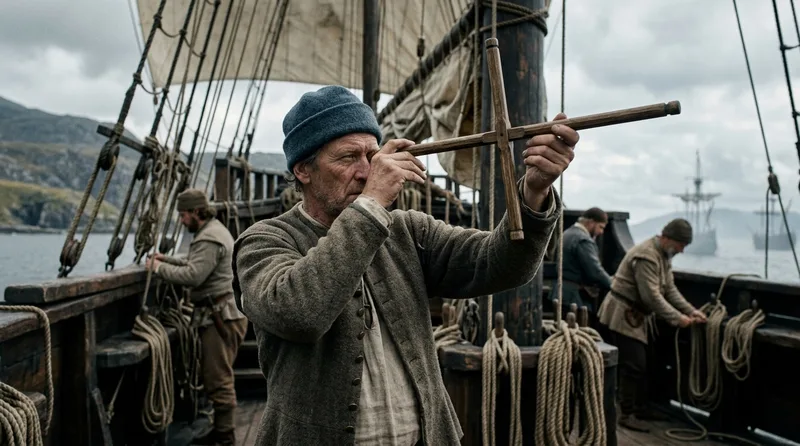
4. The Backstaff Protected Navigators’ Vision While Measuring Solar Altitude
English sea captain John Davis invented the backstaff in 1594 after losing partial vision from years of sun sightings with a cross-staff. This revolutionary instrument let navigators turn their backs to the sun, aligning a shadow with the horizon instead of staring at blinding light. The device featured two arcs—a smaller 60-degree arc near the eye and a larger 30-degree arc at the far end—that worked together to measure solar altitude up to 90 degrees. Dutch East India Company regulations in 1602 mandated backstaffs on all voyages to the Indies, reducing navigator blindness by 80 percent within a decade. The instrument’s wooden construction made it lighter than brass astrolabes, weighing just 2 pounds compared to 6 or 7. By 1620, English instrument makers in London produced backstaffs with ivory scales and mahogany frames, selling for 15 shillings each—expensive but within reach of prosperous merchant captains. Samuel de Champlain used a backstaff to chart the St. Lawrence River in 1608, taking 43 solar observations that placed Quebec’s latitude within 5 minutes of arc of its true position. The backstaff dominated English and Dutch navigation for 150 years, only yielding to the reflecting quadrant in 1731. Its invention extended navigators’ working lives by decades, preventing the premature blindness that had forced many skilled pilots into early retirement during the cross-staff era.
Source: britannica.com
5. The Nocturnal Turned Star Patterns Into a Celestial Clock
Medieval astronomers developed the nocturnal around 1290 as a time-telling device that measured the rotation of stars around Polaris throughout the night. The instrument consisted of two brass discs—an outer calendar disc and an inner rotating arm—that navigators aligned with the pointer stars of the Little Dipper to determine time accurate within 15 minutes. Spanish pilot Martín Cortés described its maritime use in his 1551 treatise “Arte de Navegar,” which became required reading for all pilots in the Casa de Contratación. The nocturnal proved indispensable for dead reckoning, the technique of calculating position by measuring speed, time, and direction. A ship sailing at 6 knots for 4 hours traveled 24 nautical miles—but only if the pilot knew exactly how much time had passed. Venetian workshops produced pocket-sized nocturnals starting in 1480, with bronze examples measuring just 4 inches in diameter and weighing 3 ounces. English explorer Martin Frobisher carried a nocturnal on his 1576 voyage to the Canadian Arctic, where summer’s endless daylight made sun-based timekeeping impossible but star-based measurement remained accurate. The device worked only in the Northern Hemisphere—Southern Cross measurements required entirely different calculations that European navigators didn’t master until the 1610s. Despite this limitation, nocturnals remained essential backup instruments through the 1700s, providing time data when cloud cover obscured the sun but stars remained visible through gaps in the weather.
Source: britannica.com
6. The Traverse Board Created a Visual Record of Every Course Change
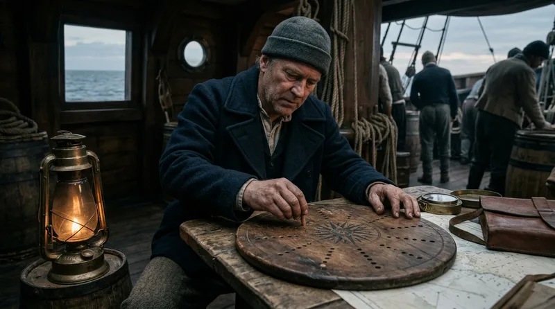
Dutch mariners invented the traverse board around 1550 as a memory aid that eliminated the need for constant log-writing during night watches. This circular wooden board featured a painted compass rose with 8 holes along each of the 32 compass points, plus a second section with rows of holes for speed measurements. Every half hour, the helmsman inserted a wooden peg into the hole corresponding to the ship’s current heading and speed. After a 4-hour watch, the pattern of 8 pegs per compass point revealed every course change and speed variation, which the navigator then transcribed into the ship’s log. English Navy regulations in 1590 standardized traverse board dimensions at 18 inches square, painted black with white markings visible in lantern light. The system proved foolproof even with illiterate crew members—inserting pegs required no writing skills, yet preserved navigation data perfectly. Spanish treasure galleons crossing the Pacific from Manila to Acapulco used traverse boards throughout the 12,000-mile voyage, which took 4 to 6 months and required tracking approximately 3,000 course changes. The board’s visual nature allowed captains to spot patterns instantly: a predominance of pegs on westward points meant favorable winds, while scattered pegs across multiple quadrants indicated storm conditions requiring constant tacking. Modern recreation tests show traverse boards maintained accuracy within 5 percent over multi-week voyages, making them as reliable as written logs but far faster to use under the pressure of changing weather and dark conditions.
Source: britannica.com
7. The Chip Log Transformed Speed Estimation Into Mathematical Precision
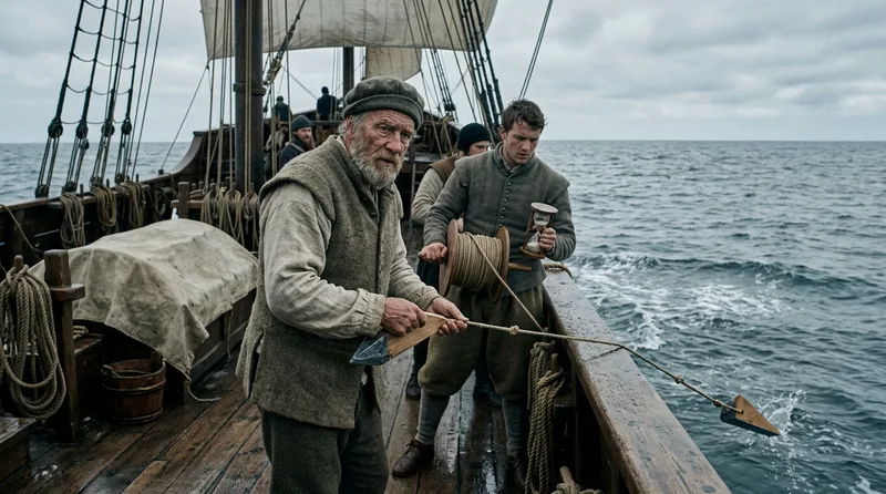
English sailors developed the chip log around 1570, replacing guesswork speed estimates with measured data accurate to within half a knot. The device consisted of a wooden board attached to 300 feet of line with knots tied every 47 feet 3 inches—a distance calculated to represent one nautical mile per hour when measured over 28 seconds. Two sailors operated the log: one threw the board overboard and let line play out while his partner timed the operation with a 28-second sandglass. Counting the number of knots that passed through his hands before time expired gave the ship’s speed in “knots,” the term still used today. Dutch East India Company ships carried chip logs on all voyages after 1600, with regulations requiring speed measurements every hour during daylight. The log board itself measured 8 by 6 inches, weighted on one edge to float vertically and create water resistance—if it laid flat, it would simply drift along with the ship instead of remaining stationary. Portuguese navigators discovered that current affected readings, sometimes adding or subtracting 2 knots from true speed over ground. To compensate, pilots took readings at different times and averaged results, or anchored briefly to measure current speed separately. Edmund Halley used chip log data on his 1698 Atlantic survey, taking 1,247 speed measurements that helped create the first accurate ocean current map. The chip log remained standard equipment until mechanical and electronic speed sensors replaced it in the 1920s, giving mariners 350 years of reliable velocity measurement.
Source: britannica.com
8. Portolan Charts Mapped Trade Routes With Unprecedented Accuracy
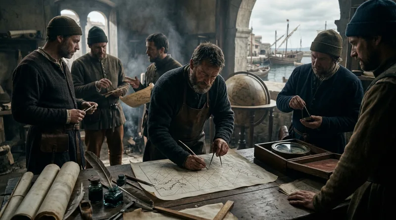
Mediterranean sailors created the first **portolan chart**s around 1270, drawing coastlines from accumulated compass bearings rather than astronomical measurements. These charts featured networks of intersecting **rhumb line**s radiating from compass roses, allowing navigators to lay a straightedge between two points and read the required magnetic bearing directly. Italian chartmaker Pietro Vesconte produced the oldest surviving dated portolan in 1311, covering the Mediterranean with accuracy that wouldn’t be surpassed for 400 years. The Black Sea measured 730 miles long on Vesconte’s chart—just 12 miles different from its true 742-mile length, a 1.6 percent error remarkable for the medieval period. Spanish and Portuguese chartmakers extended portolan coverage to Atlantic coasts after 1400, incorporating data from each successful voyage. Juan de la Cosa created a world portolan in 1500 showing the Caribbean discoveries, the first map to depict any part of the Americas. These charts used no latitude or longitude grids—instead, navigators followed rhumb lines representing constant compass bearings, which worked perfectly for Mediterranean distances but accumulated errors over oceanic voyages exceeding 1,000 miles. A ship following a single rhumb line from Spain to the Caribbean would arrive 60 miles south of its intended destination due to the convergence of meridians, a problem chartmakers didn’t solve until 1569 when Gerardus Mercator invented his famous projection. Despite this limitation, portolan charts revolutionized navigation by transforming verbal sailing directions into precise visual routes that any literate sailor could follow.
Source: britannica.com
9. Sandglass Timekeepers Turned Minutes Into Measurable Navigation Data

Venetian glassblowers perfected the maritime sandglass around 1350, creating hermetically sealed hourglasses that maintained accuracy within 2 percent despite humidity and temperature changes at sea. Ships carried sets of 9 different glasses: a 30-minute glass for general timekeeping, a 28-second glass for chip log measurements, and seven others ranging from 1 to 4 hours for celestial observations and watch changes. Spanish regulations in 1573 required all trans-Atlantic vessels to carry at least 18 sandglasses as redundant backups, since a single broken timer could throw navigation calculations off by hours. The ship’s page—usually a boy between 10 and 14 years old—had sole responsibility for turning glasses and announcing time by ringing bells. Records from the 1545 wreck of the Mary Rose show that elite hourglasses used powdered marble instead of sand, which flowed more consistently in cold conditions. Every grain had to pass through holes measuring exactly 2 millimeters in diameter, hand-drilled with hot copper wire by specialized craftsmen in Murano who guarded their techniques as trade secrets. Ferdinand Magellan’s 1519 circumnavigation required 288 glass turns per day, creating 105,120 opportunities for error during the 1,095-day voyage. To verify accuracy, navigators compared sandglass time against nocturnal measurements or solar observations—if the two diverged by more than 15 minutes, they knew a glass was running fast or slow. This cross-checking proved essential since a 5-minute timing error in a 4-hour sail at 6 knots resulted in a 30-mile position error.
Source: britannica.com
10. The Kamal Brought Arab Navigation Wisdom to European Ships
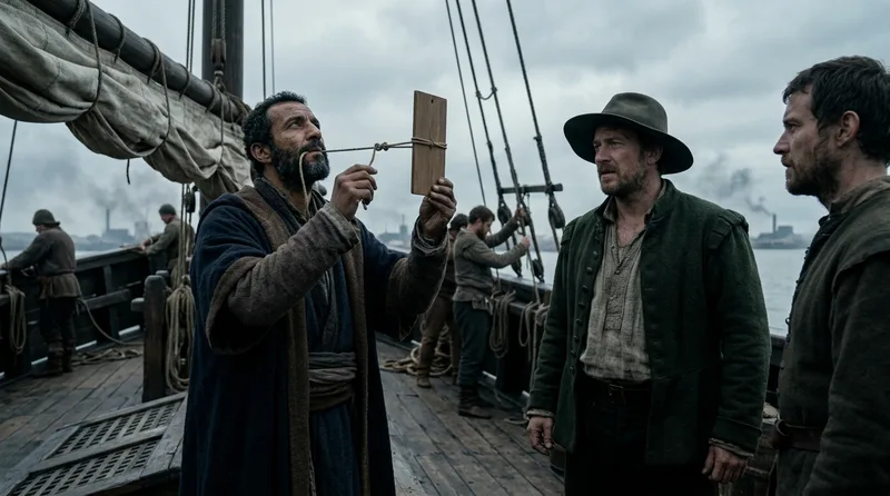
Arab navigators perfected the kamal around 900 CE as a simple latitude-measuring tool consisting of a wooden rectangle attached to a knotted cord. The navigator held the cord in his teeth at a specific knot, extended the board at arm’s length, and adjusted until the board’s lower edge touched the horizon while its upper edge aligned with a star. Each knot position corresponded to one degree of latitude—the navigator simply counted knots to determine his position. Portuguese sailors adopted the kamal around 1460 after observing Indian Ocean navigators using it from East Africa to Indonesia. The device measured just 2 by 1.5 inches, cost virtually nothing to produce, and required no mathematical calculation to use. Ahmad ibn Mājid, the Arab pilot who guided Vasco da Gama from Malindi to Calicut in 1498, used a kamal with 13 different knot positions allowing measurements from 10 to 76 degrees north. The instrument’s cord typically measured 42 inches, a length derived from the average distance from eye to outstretched hand among adult males. Unlike the astrolabe, which required stable conditions and mathematical tables, the kamal worked in rolling seas and needed only familiarity with star positions. European navigators called it the “Indian cross-staff” and valued it as a backup when brass instruments were damaged. The kamal revealed sophisticated mathematics hidden in apparent simplicity—the spacing between knots compensated for the changing angular size of one degree of latitude at different distances from the equator, a geometric principle Arab scholars had calculated centuries before European mathematicians rediscovered it.
Source: britannica.com
Did You Know?
The kamal’s knotted cord contained the same trigonometric calculations that European mathematicians labored over with quill and parchment—Arab navigators had simply encoded the math into a physical tool centuries earlier. When Portuguese sailors finally adopted the kamal in 1460, they were unwittingly carrying ninth-century Islamic astronomy across the Atlantic, proving that the Age of Exploration wasn’t just European innovation but a fusion of Mediterranean, Arab, and Chinese technologies that no single culture could have achieved alone.